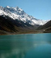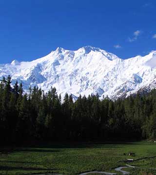
Fairy Meadows famous for its beautiful lush green plateaus and World’s ninth biggest mountain Nanga Parbat (the Killer Mountain) is located in Diamer District of Gilgit-Baltistan region, Pakistan. The place was named Fairy Meadows in 1953 by an Australian climber Hermann Bhul due to its mesmerizing beauty. He was here to climb the peak of Nanga Parbat. He became the first one to summit the mountain. Fairy Meadows is also called “Heaven on Earth” due to its matchless beauty.
Contents:
Overview:
A night camping or stay in traditionally constructed wooden cottage at Fairy Meadows with a breathtaking view of mighty Nanga Parbat’s North face is very unique and wonderful experience. Even more if sky is clear and night is full moon. The cool moonlight reflecting from the gigantic majestic icy peak shows the real meaning of nature’s beauty and peace.
How to reach?
The first stop near Fairy Meadows is Raikot Bridge. It is located at an altitude of 4595 feet (1400 meters) above sea level and about 540 kilometers (336 miles) from Islamabad (the capital of Pakistan), when coming through Karakoram Highway.
From Raikot Bridge you can hire a local jeep to reach Tatoo Village at an altitude of 9515 feet (2900 meters) above sea level. It will take about half hour of exciting journey to reach Tatoo Village.
Onwards from Tattu route becomes too narrow for a jeep to travel but not very difficult for trekking. After two to three hours of trekking depending on your fitness level, you’ll reach Fairy Meadows.
Where to stay?
There are several hotels and tourist lodges are available to facilitate tourists in Fairy Meadows. Most of them of are available at very reasonable prices. A few although are little expensive. Many tourists like to stay in camps on grassy places.
Food is expensive here as compared to cities. But availability of food at this remote place makes it worth paying.
When to visit?
The best time to visit Fairy Meadows is between end of June and middle of August. The place becomes inaccessible in winter due to heavy snowfall.
Map
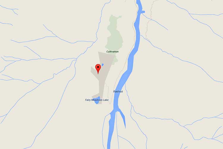
Map of Fairy Meadows – click on map image to see detailed map