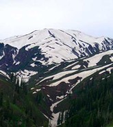
Mushkpuri is the second highest hill of Galyat. It is located in the Hills of Nathiagali in District Abbottabad, Khyber Pakhtunkhwa, Pakistan. There is a three hour long but safe hill trek to the top. It is approximately 9452 feet (2,800 meters) above sea level.
Trek to Mushkpuri top starts from Nathiagali spiraling upward through green pine forests. It is a 4 kilometers (2.5 miles) of climb. The way to the top is very breathtaking. It is full of greenery and is rich with fragmented flowers, like a carpet full of flowers. Especially at the end of the rainy season it gives a very attractive view to the hikers.
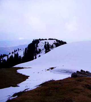
There is another trek to Mushkpuri which starts from Dungagali. The slope on this route is steeper than the trek coming from Nathiagali. From the trek Mushkpuri to Dungagali down below there is a great sight of Ayubia National Park. There is a water pond at the Mushkpuri top which gives beautiful reflection of trees and the sky. From Mushkpuri top Kashmir valley can also be seen.
Map:
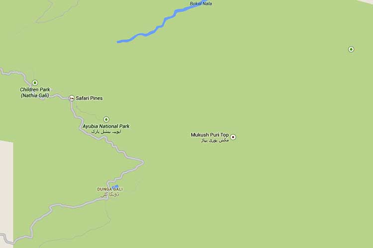
Map of Mushkpuri – click on map image to see detailed map